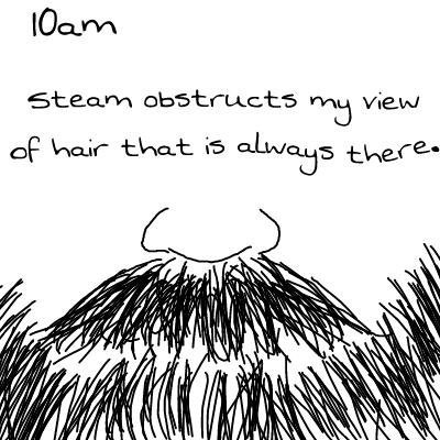


Con Man Trailer
Amy’s attempt at a wink: close both eyes and then open just one


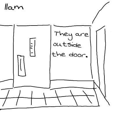
Con Man Trailer
Amy’s attempt at a wink: close both eyes and then open just one


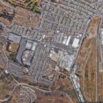
I was futzing around on Google maps, checking out city boundaries and such, and I noticed that the border between the cities of San Francisco and Daly City cuts right through the middle of suburban blocks. I checked to see if those bisected blocks included funny-angled houses that were built to accommodate such a goofyass border, but nope, the official boundary line cuts right through the middle of some houses.
And I could not process this. It broke me for a few minutes. I was a puddle of a person.
So I spent even more time zooming in and around, checking out houses and street signs, looking for some method to the madness. I finally noticed that the streets were paved differently
more or less along the boundary line (much nicer on the Daly City side). So I had to go and draw my own boundary lines and highlights to confirm that, yeah, I guess it’s possible, but jesus it still hurts my brain. I mean that city border doesn’t zig and zag to match what appears to be the reality of living there. It just slices through houses like they don’t matter. Are the city gov’t types too lazy to update the border with that level of granularity? Do residents realize it’s ultimately a pointless problem and thus leave it alone instead of seeking some kind of measure to update the border on maps? Is this just Google’s shortcut so they don’t need to draw that wacky border?
And and, no one has written about this! There’s a dearth of in-depth discussion about this mindfuck of a border. This photothinkpiece about San Francisco’s edges mentions it, but that’s it.
It’s almost one-thirty in the morning and I think, maybe, I can finally sleep. But I’ll be heading up there at some point to walk it for myself. Get the real scoop, you know.
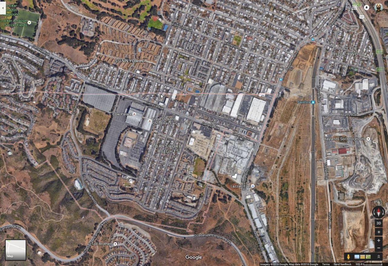
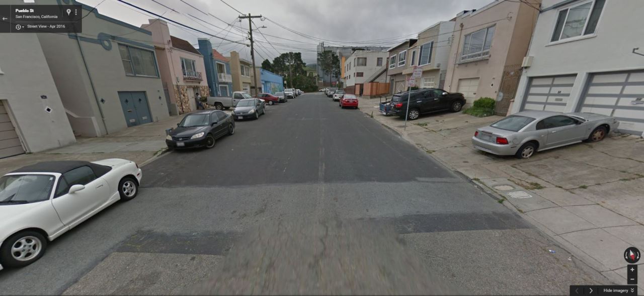
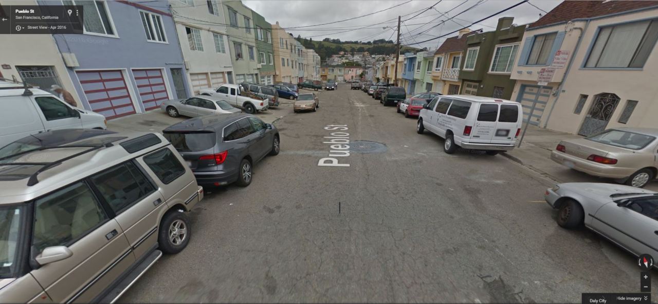
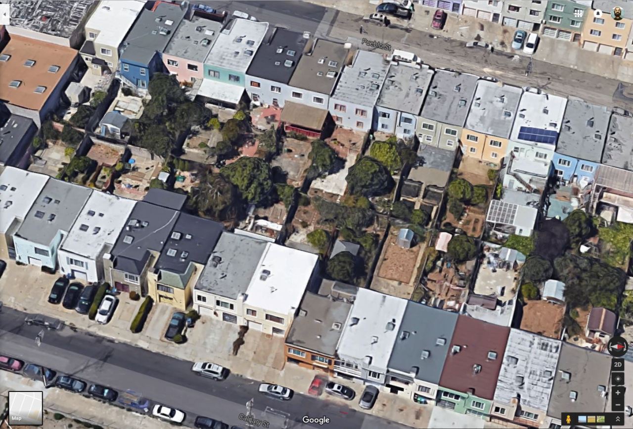
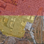
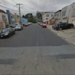
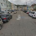
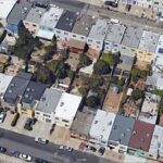
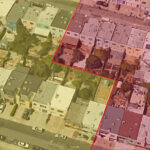
I was futzing around on Google maps, checking out city boundaries and such, and I noticed that the border between the cities of San Francisco and Daly City cuts right through the middle of suburban blocks. I checked to see if those bisected blocks included funny-angled houses that were built to accommodate such a goofyass border, but nope, the official boundary line cuts right through the middle of some houses.
And I could not process this. It broke me for a few minutes. I was a puddle of a person.
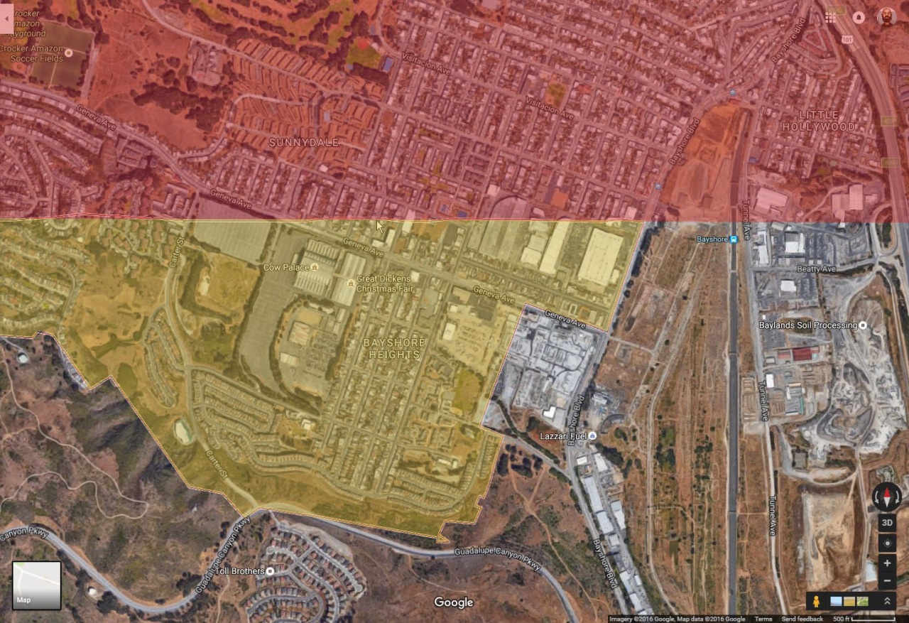
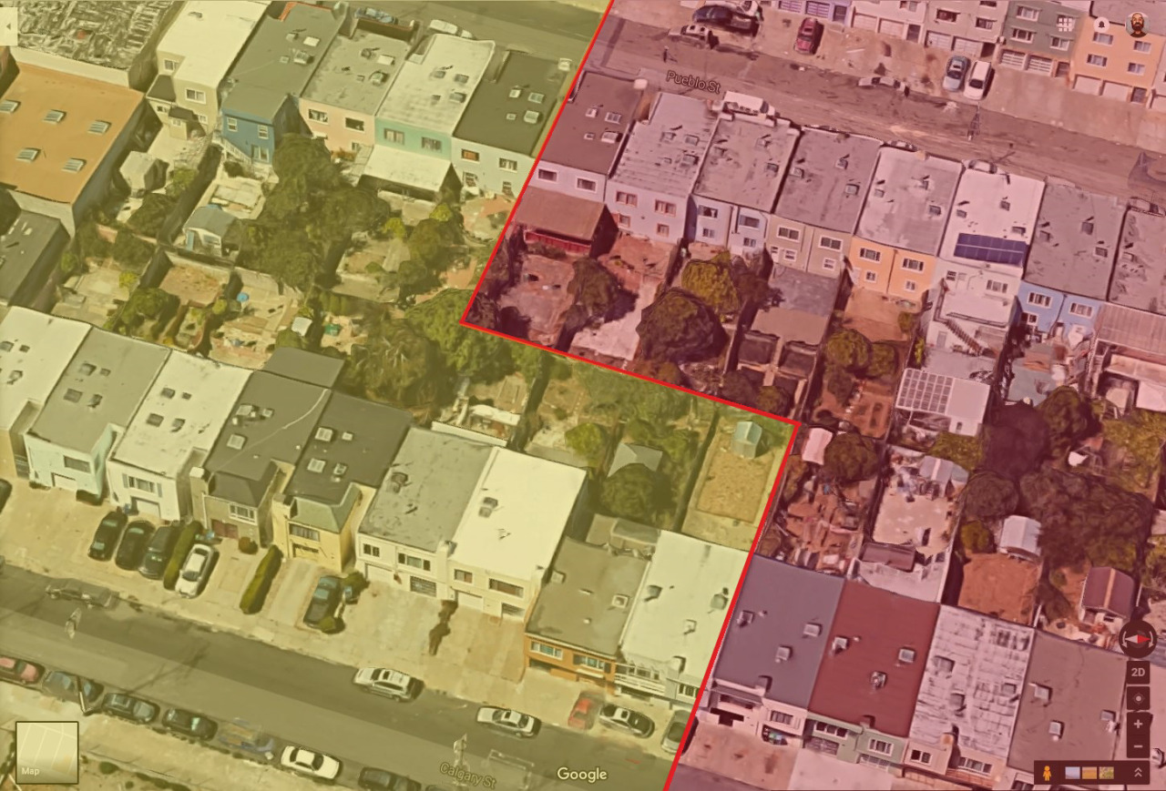
So I spent even more time zooming in and around, checking out houses and street signs, looking for some method to the madness. I finally noticed that the streets were paved differently
more or less along the boundary line (much nicer on the Daly City side). So I had to go and draw my own boundary lines and highlights to confirm that, yeah, I guess it’s possible, but jesus it still hurts my brain. I mean that city border doesn’t zig and zag to match what appears to be the reality of living there. It just slices through houses like they don’t matter. Are the city gov’t types too lazy to update the border with that level of granularity? Do residents realize it’s ultimately a pointless problem and thus leave it alone instead of seeking some kind of measure to update the border on maps? Is this just Google’s shortcut so they don’t need to draw that wacky border?
And and, no one has written about this! There’s a dearth of in-depth discussion about this mindfuck of a border. This photothinkpiece about San Francisco’s edges mentions it, but that’s it.
It’s almost one-thirty in the morning and I think, maybe, I can finally sleep. But I’ll be heading up there at some point to walk it for myself. Get the real scoop, you know.