I just had the best chocolate cookie I’ve ever eaten in my life. It’s unlike any cookie I’ve ever experienced, a texture and consistency that defies the collective understanding of a cookie. Soft and crumbly, chocolate filled, with ground espresso beans and topped with a marshmallow semi-melted across the top. It’s absurdly decadent for a cookie but nothing compares. This is it. What a thrill, sheer joy and wonder at the amazing things we can make for each other. Don’t wake me, let this cloud lift me to the moon. I want to die if this is the final experience I get to have as a living man. I will haunt no one for all my unresolved matters are vanishing mist in the light of this revelation. Peace be with you and this baker.
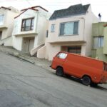
Not sure what was going on in the 70s to make everyone latch onto oranges and browns, but our family car for a chunk of the 90s was this exact model and color of shorty. Our pop tricked it out with wood paneling and brown carpet, a bench seat in the back, and big windows on both sides.
It’s always fun to come across these in scrapyards and investigate how someone else decided to mod theirs. It’s super rare to see a working one in the wild!
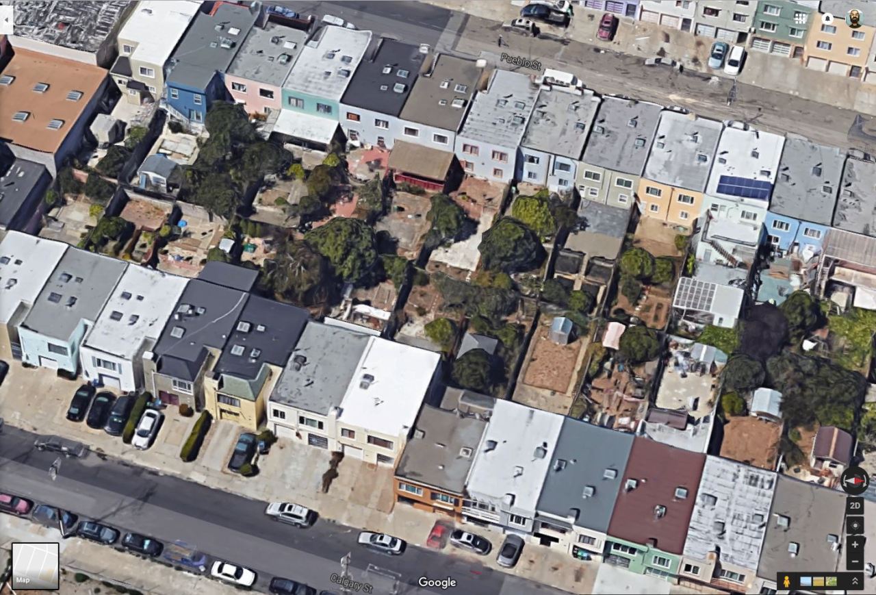
I was futzing around on Google maps, checking out city boundaries and such, and I noticed that the border between the cities of San Francisco and Daly City cuts right through the middle of suburban blocks. I checked to see if those bisected blocks included funny-angled houses that were built to accommodate such a goofyass border, but nope, the official boundary line cuts right through the middle of some houses.
And I could not process this. It broke me for a few minutes. I was a puddle of a person.
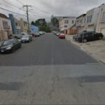
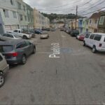
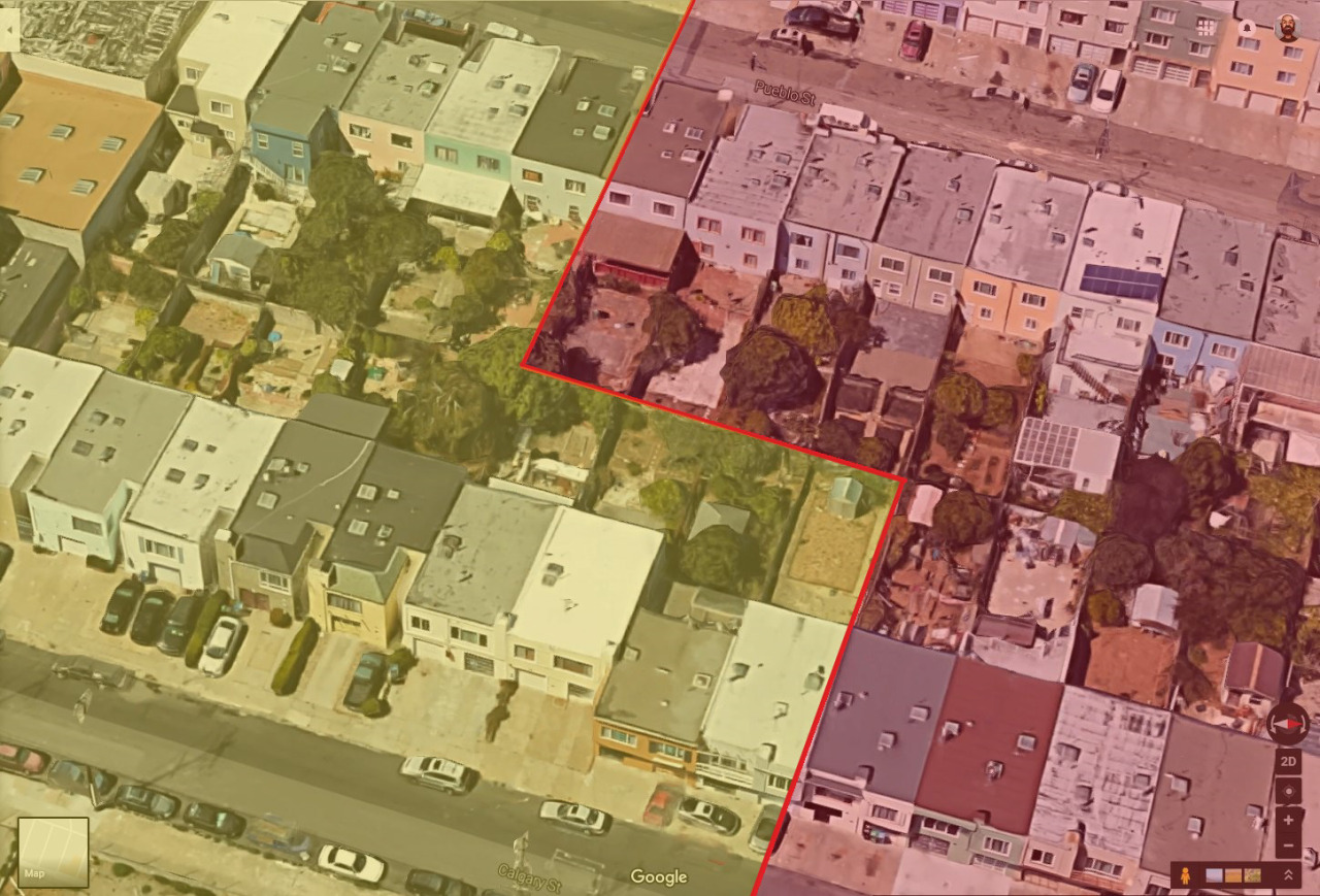
So I spent even more time zooming in and around, checking out houses and street signs, looking for some method to the madness. I finally noticed that the streets were paved differently
more or less along the boundary line (much nicer on the Daly City side). So I had to go and draw my own boundary lines and highlights to confirm that, yeah, I guess it’s possible, but jesus it still hurts my brain. I mean that city border doesn’t zig and zag to match what appears to be the reality of living there. It just slices through houses like they don’t matter. Are the city gov’t types too lazy to update the border with that level of granularity? Do residents realize it’s ultimately a pointless problem and thus leave it alone instead of seeking some kind of measure to update the border on maps? Is this just Google’s shortcut so they don’t need to draw that wacky border?
And and, no one has written about this! There’s a dearth of in-depth discussion about this mindfuck of a border. This photothinkpiece about San Francisco’s edges mentions it, but that’s it.
It’s almost one-thirty in the morning and I think, maybe, I can finally sleep. But I’ll be heading up there at some point to walk it for myself. Get the real scoop, you know.
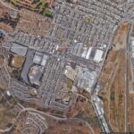
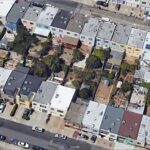
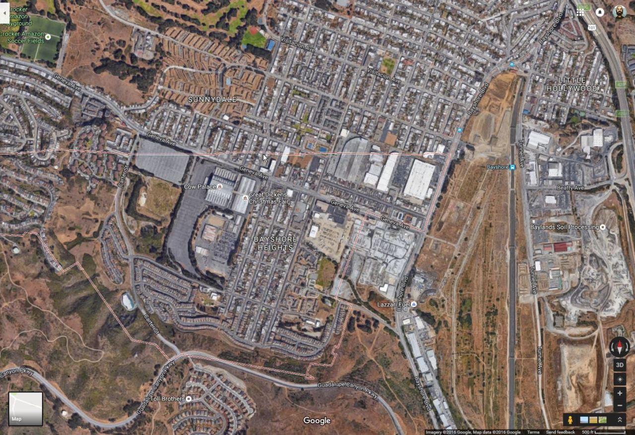
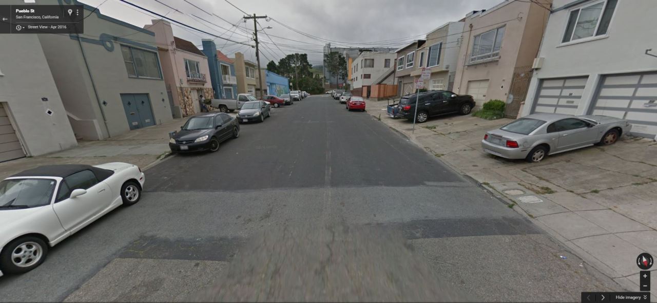
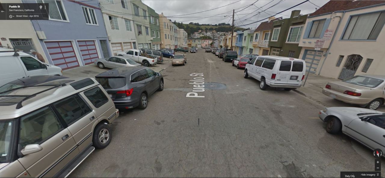
I was futzing around on Google maps, checking out city boundaries and such, and I noticed that the border between the cities of San Francisco and Daly City cuts right through the middle of suburban blocks. I checked to see if those bisected blocks included funny-angled houses that were built to accommodate such a goofyass border, but nope, the official boundary line cuts right through the middle of some houses.
And I could not process this. It broke me for a few minutes. I was a puddle of a person.
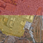
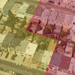
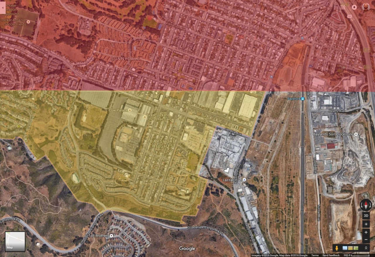
So I spent even more time zooming in and around, checking out houses and street signs, looking for some method to the madness. I finally noticed that the streets were paved differently
more or less along the boundary line (much nicer on the Daly City side). So I had to go and draw my own boundary lines and highlights to confirm that, yeah, I guess it’s possible, but jesus it still hurts my brain. I mean that city border doesn’t zig and zag to match what appears to be the reality of living there. It just slices through houses like they don’t matter. Are the city gov’t types too lazy to update the border with that level of granularity? Do residents realize it’s ultimately a pointless problem and thus leave it alone instead of seeking some kind of measure to update the border on maps? Is this just Google’s shortcut so they don’t need to draw that wacky border?
And and, no one has written about this! There’s a dearth of in-depth discussion about this mindfuck of a border. This photothinkpiece about San Francisco’s edges mentions it, but that’s it.
It’s almost one-thirty in the morning and I think, maybe, I can finally sleep. But I’ll be heading up there at some point to walk it for myself. Get the real scoop, you know.